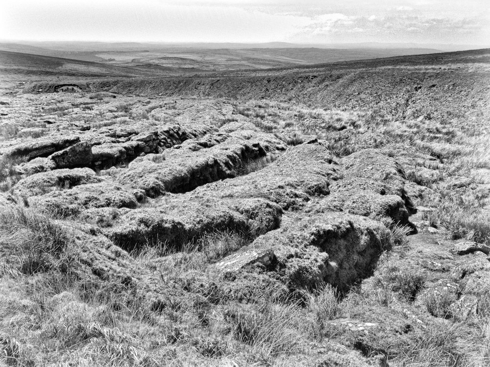


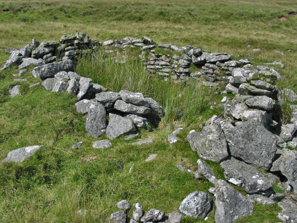
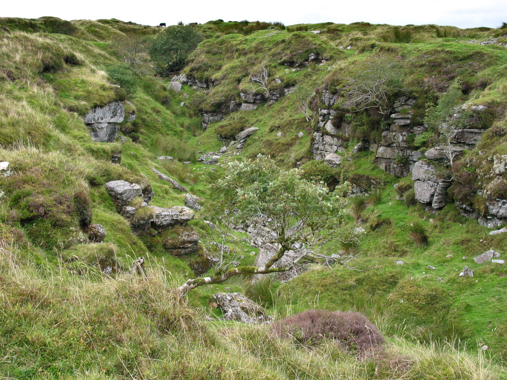


Above are photos show examples of: various tinners’ remains, including “streamworks”, “openworks”, “lodeback workings”. Associated with streamworks are buildings called “tinners’ huts” (also called “lodges”).
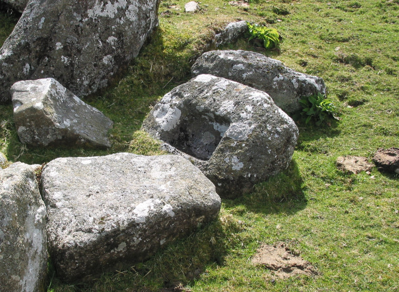
To crush the ore “stamps” were used. The stamps smashed the tin ore on “mortar” stones, creating a fine ore powder. This was processed, in “buddles”, to separate off the waste and leaving pure ore. The pure ore was then smelted. To obtain high quality tin the best fuel was peat charcoal. To make it: dried peat was heaped into mounds, covered in turf and then fired (the turf preventing burning). The remains are called “meilers”. In “blowing houses” molten tin was poured into “mould” stones to create the portable ingots.


Written by:
Further Information (sources read)
Information on Meilers:
Documents by Phil Newman:
“Domestic and Industrial Peat Cutting on North-Western Dartmoor, Devonshire: An archaeological and historical investigation”,
“The Upper Erme Valley, Dartmoor National Park, Devon, An Archaeological Survey”
“The Archaeological Legacy of the Dartmoor Carbonarii, Project background and future research proposal” these can be found on his website:
https://www.philnew.co.uk/downloads
Locations of Open Work:
Sandy Gerrard: “The Archaeology of Dartmoor – Perspectives from the 1990’s” Devon Archaeological Society Proceedings No. 52 1994, page 185 Fig. 8.
Method: I scanned the page into a image file, geo-referenced it, then overlaid it in Google Earth. I found a some errors in Gerrard’s locations, and some seem to be Lodeback. I added a few Open Works and Lodebacks I know of.
Mortars & Moulds:
Worth’s: “Dartmoor” (my copy printed in 1971) in chapter “The Dartmoor Blowing-House”.
Tom Greeves: “Lodges and Mills” pages 66 to 73 – found in the “The Tinworking Landscape of Dartmoor in a European Context”, published by DTRG 2017
Location of tin streamworks, tinners’ huts and prehistoric hut-circles:
Jeremy Butler’s comprehensive work, “Dartmoor Atlas of Antiquities” Volumes 1-4.
With additional locations of sites I’ve found – several already recorded at HER.
(Method: using J.B’s. map I have zoomed in with Google Earth and drawn lines around the streamwork, or added a marker for hut-circles, and saved these as files. Then I used GIS software to input the Google Earth vector files, and raster LiDAR – to verify sites.
LiDAR files are from the government website: https://environment.data.gov.uk/DefraDataDownload/?Mode=survey (please note their copyright notice)
GIS (Geographic Information System), software QGIS website: https://qgis.org/en/site/
Google Earth – https://earth.google.com/web/ Software program (called “Earth”) is on this page: https://about.google/intl/en/products/?tab=uh
All images and photographs are my own.
Leave a Reply
You must be logged in to post a comment.